
File:Allegheny Monongahela Ohio.jpg
Size of this preview: 800 × 508 pixels. Other resolutions: 320 × 203 pixels | 640 × 406 pixels | 1,024 × 650 pixels | 1,446 × 918 pixels.
Original file (1,446 × 918 pixels, file size: 1.38 MB, MIME type: image/jpeg)
|
This is an image of a place or building that is listed on the National Register of Historic Places in the United States of America. Its reference number is 79003143. |
| Description |
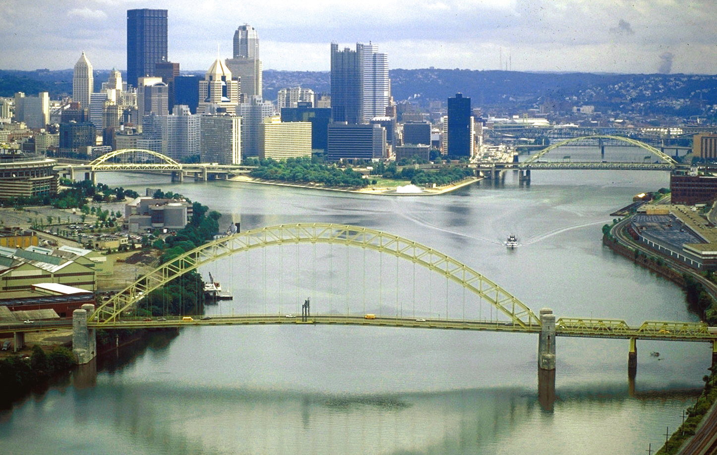
English: The source of the Ohio River at “The Point” in Point State Park, Pittsburgh, Pennsylvania.
|
|||
| Date | ||||
| Source |
U.S. Army Corps of Engineers Digital Visual Library Image page Image description page Digital Visual Library home page |
|||
| Author | David Schwab, U.S. Army Corps of Engineers | |||
| Permission (Reusing this file) |
|
|||
| Location | Pittsburgh, Pennsylvania, USA |
| Camera location | | View this and other nearby images on: OpenStreetMap |
|---|
| This is a retouched picture, which means that it has been digitally altered from its original version. Modifications: colors adjusted. Modifications made by Glabb.
|
File history
Click on a date/time to view the file as it appeared at that time.
| Date/Time | Thumbnail | Dimensions | User | Comment | |
|---|---|---|---|---|---|
| current | 12:06, 25 Juun 2010 | | 1,446 × 918 (1.38 MB) | Glabb | colors adjusted |
| 00:31, 24 Maach 2007 |  | 1,446 × 918 (417 KB) | DanMS | {{Information | Description = {{en|The source of the Ohio River at “The Point” in Pittsburgh, Pennsylvania, USA. The Allegheny River (left) and the Monongahela River (right) join to form the Ohio here. The West End Bridge crosses the Ohio in the fo |
File usage
The following page uses this file:
Global file usage
The following other wikis use this file:
- Usage on ar.wikipedia.org
- Usage on ba.wikipedia.org
- Usage on bg.wikipedia.org
- Usage on bs.wikipedia.org
- Usage on da.wikipedia.org
- Usage on de.wikipedia.org
- Usage on el.wikipedia.org
- Usage on en.wikipedia.org
- City
- Ohio River
- Allegheny River
- List of crossings of the Ohio River
- West End (Pittsburgh)
- Confluence
- West End Bridge
- List of bridges of Pittsburgh
- National Register of Historic Places listings in Pittsburgh, Pennsylvania
- List of Pennsylvania state historical markers in Allegheny County
- User:OrdinaryGiraffe/Books/Vital/L2/A
- Usage on fa.wikipedia.org
- Usage on fo.wikipedia.org
- Usage on fr.wikipedia.org
- Usage on fy.wikipedia.org
- Usage on hy.wikipedia.org
- Usage on incubator.wikimedia.org
- Usage on it.wikipedia.org
- Usage on ja.wikipedia.org
- Usage on ka.wikipedia.org
- Usage on kn.wikipedia.org
- Usage on lt.wikipedia.org
- Usage on mr.wikipedia.org
- Usage on nl.wikipedia.org
- Usage on nn.wikipedia.org
- Usage on no.wikipedia.org
- Usage on pnb.wikipedia.org
- Usage on pt.wikipedia.org
- Usage on ru.wikipedia.org
- Usage on ru.wiktionary.org
- Usage on sr.wikipedia.org
- Usage on sv.wikipedia.org
View more global usage of this file.